FIELD REPORT
LAGANGARBH HUT
ADVENTURER: JED EDWARDS
ACTIVITIES
Two nights staying in a mountain hut, with two days walking in mountainous terrain.
WEATHER CONDITIONS
5-12°C – Variable weather (details below)
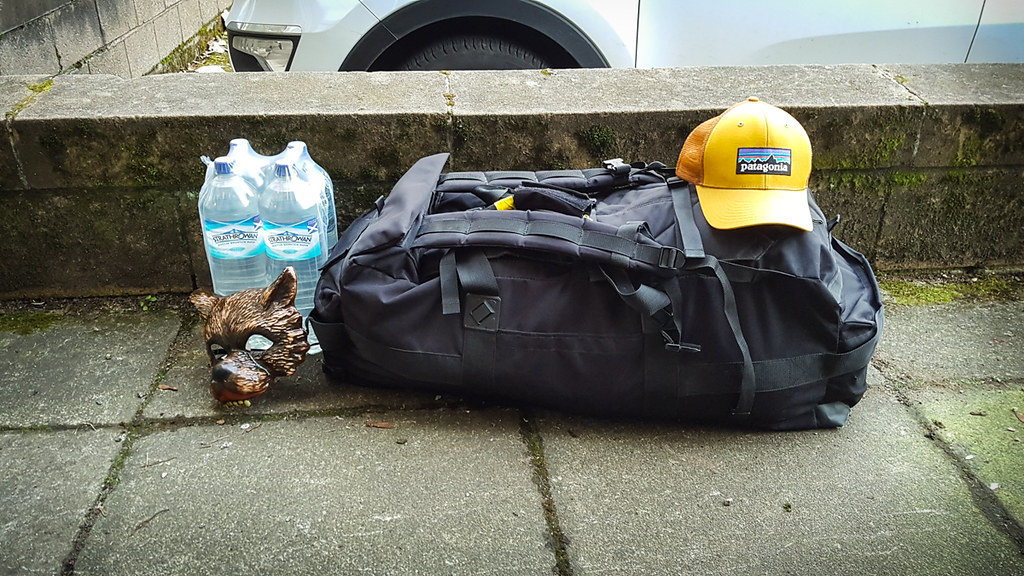
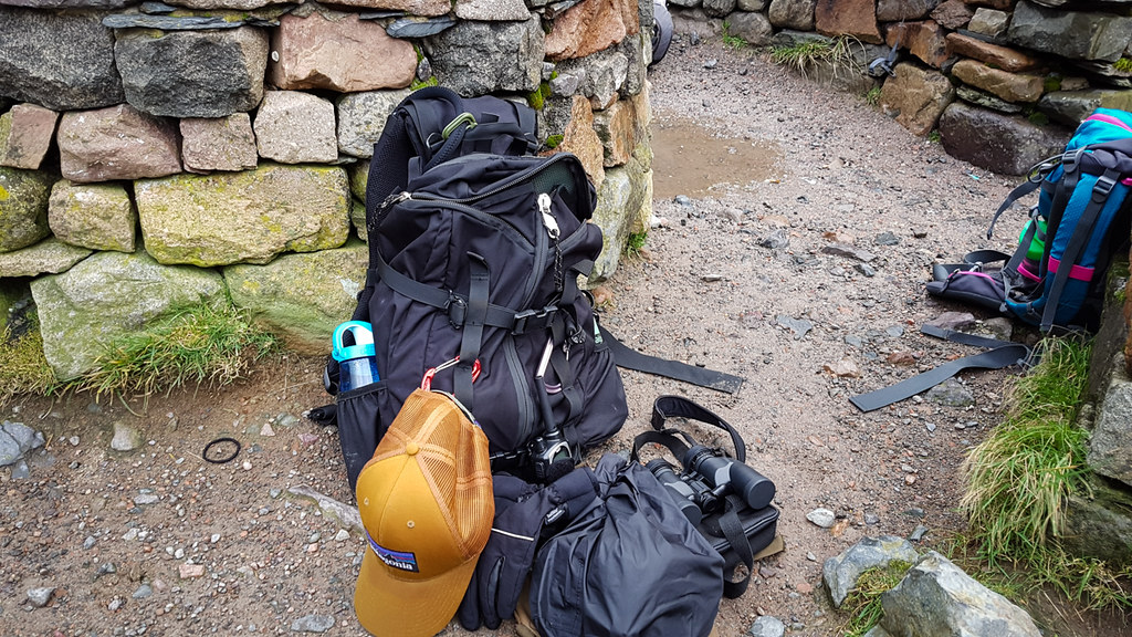
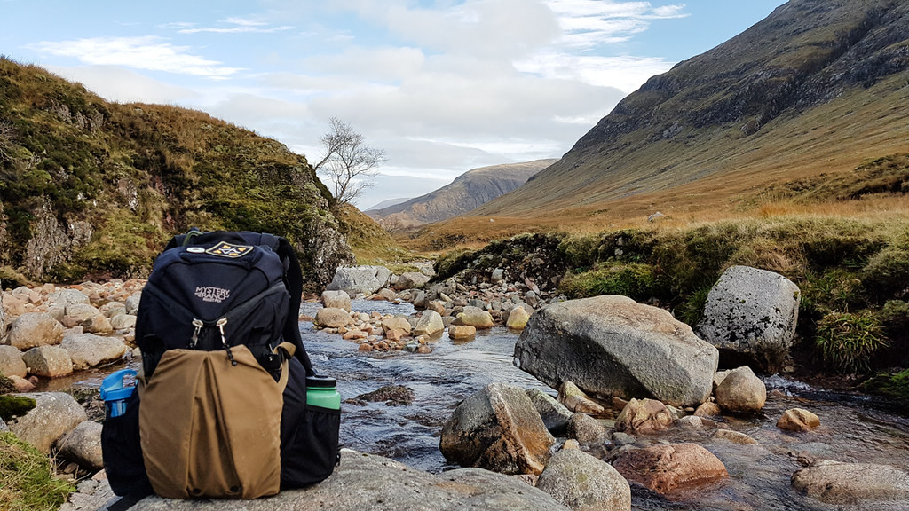
PACK
British Army surplus Deployment Bag

PACK CONTENTS
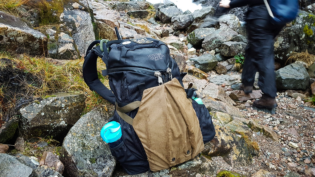
Mystery Ranch Sweet Pea pack (with Stick-it Attachment, Adapt Patch and Ru Markers)
Reebok running shoes
2x dinner, breakfast, lunch and snacks
Water, beer, coffee
Snugpak Softie 3 Expansion sleeping bag (in dry bag)
Nalgene 1L bottle, Nalgene OTF bottle
Camelbak 3L Antidote reservoir
Sealskinz Activity Gloves
Craghoppers fleece
Smartwool socks, merino underlayers
Spare clothing
2x Shemagh (green/black and plain tan), handkerchief
Toiletries and Boo-boo kit in seal-bag
Recycled Firefighter wallet
Thinsulate gloves, hat and Sealskinz socks in stuff-sack
Patagonia Torrentshell Jacket
Army surplus ‘light thermal smock’
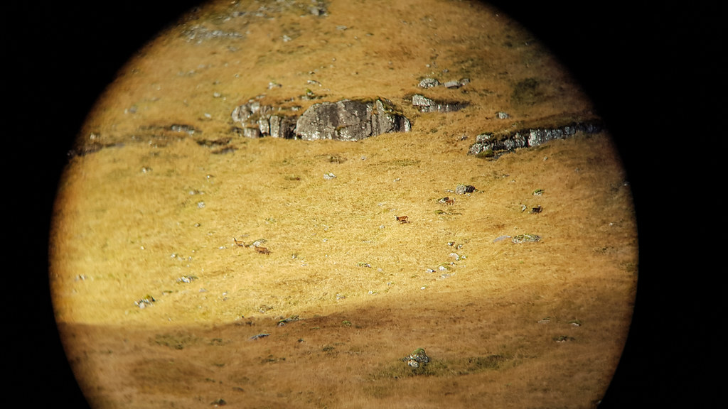
Olivon 7x30WP Binoculars
Ordnance Survey map, Silva Compass
Fire kit
Morakniv Clipper
Light My Fire titanium Spork
Ravpower battery charger
Adventure Lights Guardian light
Krill 180 light
Paracord, tape on a reel, foil blanket,
Petzl Tikka 2 headtorch in sealbag
Waterproof notebook and pencil in sealbag
Paperback book
Emergency kit with CR123 cells, personal marker panel, Clipper lighter, Explorer survival whistle, Victorinox Pioneer X
Not in picture/worn:
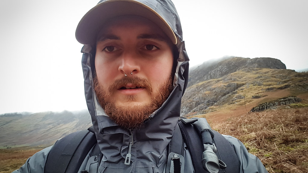
Patagonia P6 trucker hat
Craghoppers Kiwi stretch trousers
Lowa Combat GTX boots
OLight S1 Baton torch
Field Report
This trip was organised jointly between Aberdeen University Highland Frontier Society and Dundee University Rucksack Club. I’m a member of the latter but had only done single-day trips with the club so far since joining in September. This being the last weekend in October it felt like a great opportunity to get away for a few days, as we expected the weather to get much colder after that point. We departed Dundee at dusk on the friday evening and drove for nearly three hours across Scotland, arriving well after the sun had set.
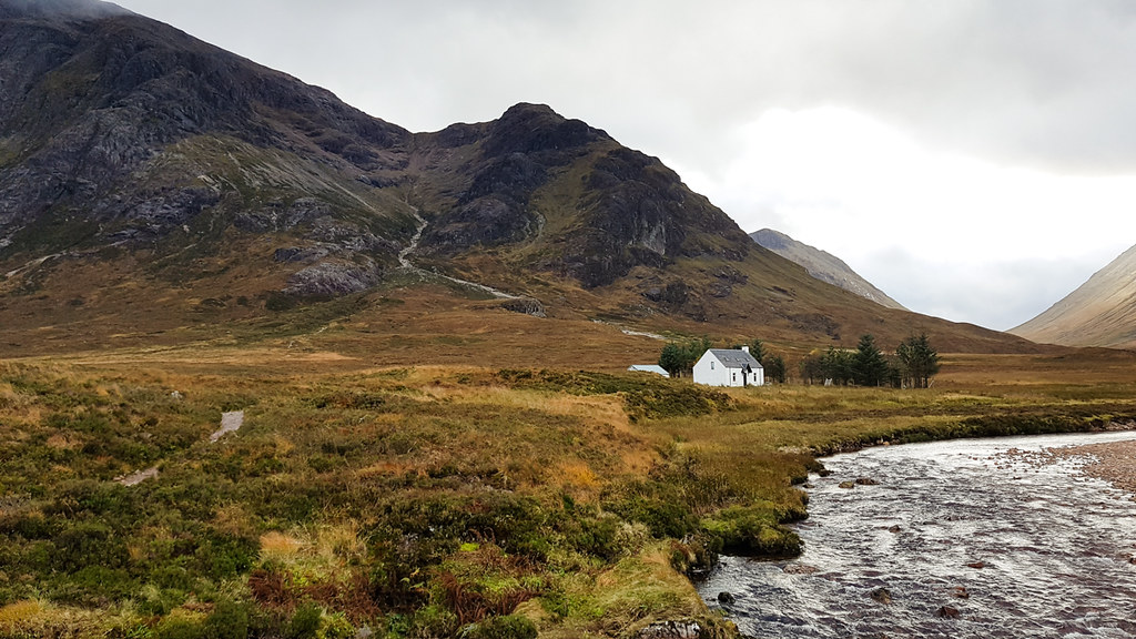
We were sleeping in Lagangarbh Hut which is maintained by the Scottish Mountaineering Club. It’s open to anyone with advance booking, but our group reserved the whole building for the weekend. The hut has electric heating and lighting, two sleeping rooms, toilets, a drying room, a living room and a very serviceable kitchen; it’s quite a step up from the stone-walled bothies that can still be found dotted about the highlands. The water in the taps isn’t good to drink, so it was necessary to pack in everything we might need for the stay. We were able to park our minibus reasonably close to the hut but still had to walk a few hundred metres to the front door. The deployment bag, at 120 Litres of space, was able to hold all of my kit for the weekend, which was more than could be said for many of my clubmates who had to do multiple runs to-and-from the hut in the dark. I used the shoulder straps to wear the bag on my back and, despite the complete lack of structure or suspension, I was able to move around without too much trouble.
We did arrive early enough for the two clubs to get acquainted and discuss activities for the Saturday, pouring over maps and checking all kit had been remembered. As one of the more experienced walkers on the route I would be following, I was asked to carry two more pieces of kit: a walkie-talkie and a ‘bothy bag’ group shelter, which could be used to keep everyone out of the wind and rain in cases of emergency. I rearranged my kit, moving everything I would need for the day into my Sweet Pea and leaving extra food, water and clothing in the deployment bag at the hut.
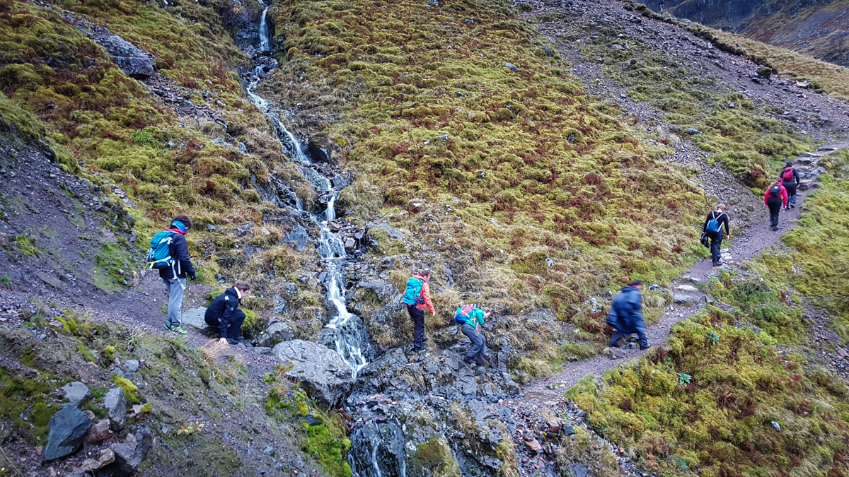
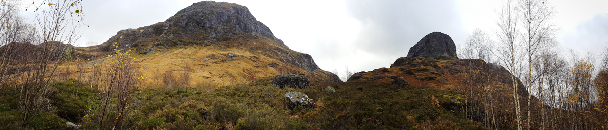
With an early start we were met by some classically Scottish weather, meaning high winds, low clouds, and a reasonable amount of rain. A large group of us took a five minute drive from Lagangarbh to the Three Sisters to walk up Coire nan Lochan, with the intention of reaching the peaks of two Munros (a collection of mountains in Scotland over 3000 feet), and descending down Glencoe’s famous Hidden Valley.
Progress started well but after a short distance the group began to split into two, going from fourteen of us in the bus to a nine and a five – this had been expected between myself and a clubmate who had planned the route (hence carrying radios), and I stuck back to make sure that the slower walkers had an experienced walker amongst them, to navigate and keep everyone safe. The biggest challenge to this, on that day, was the weather, especially as temperatures dropped and visibility closed in higher up the slopes.
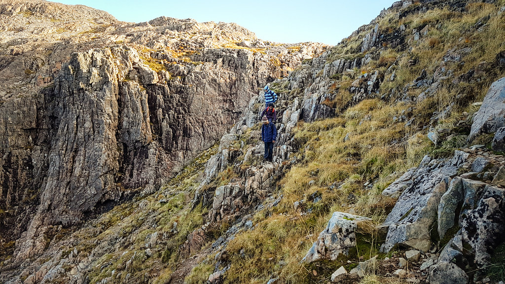
After two hours of steady climbing our clear path began to peter out and we reached a flatter area with some boggy ground. At this point we were well within the clouds and navigation became very difficult – I was confident that I knew where we were whilst looking at the map, but without clear landmarks I struggled to keep a sense of direction and could not find the ridgeline I had planned on following.
With the bad weather and some inexperienced walkers in my group I was keen to not let the situation shift from ‘not fun’ to ‘not safe’, and decided we would turn back the way we came. My group made it back to the car park comfortably in time for lunch with nothing worse than some wet feet, and a little over an hour’s wait for the ‘fast’ group to make it down the valley route they had planned, although even they had been kept from the summits by the poor conditions.
Saturday ended slightly early but in good spirits, boosted by a hearty group meal and evening activities that would be expected from a group of students. The hut’s drying room was filled with wet kit, although I was pleased that my only addition was my fleece which was still keeping me warm despite being sodden. It had been underneath my rainshell all day which lead me to suspect that the moisture had come from my own body rather than the elements. I had packed complete changes of clothing, including shoes, with the expectation that I would be soaked to the point of discomfort, but fortunately this was not the case. The hut was very comfortable for the evening, sitting at a warm enough temperature that we even needed to crack windows once or twice after some more vigorous games.
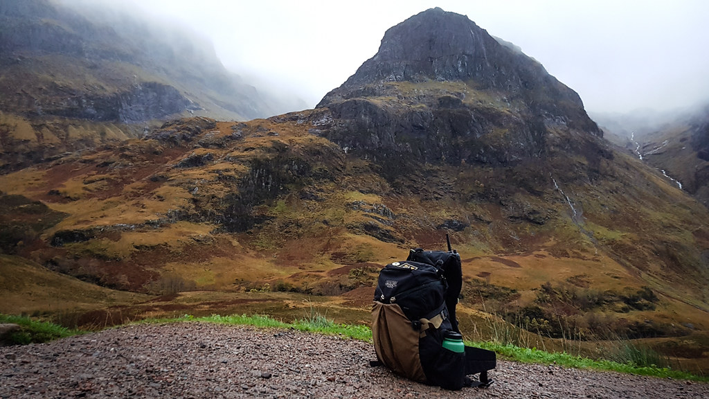
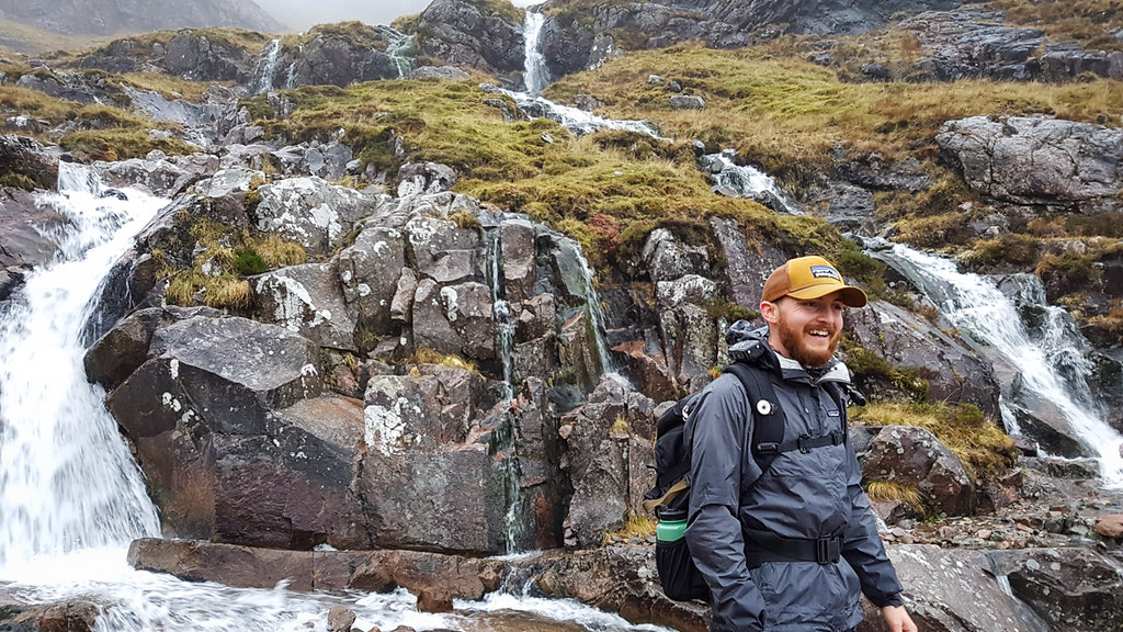
Compared with the previous day, Sunday’s weather was a complete reversal. Again I rose early and sat with my porridge near a window simply admiring the view. Lagangarbh hut sits in the shadow of Buachaille Etive Mor, a mountain seen recently in the James Bond film Skyfall. Climbing the Buachaille had been my ambition for the trip and to have such perfect weather put me in a brilliant mood to start the day. A smaller group of us – only four – were the first party to leave the hut that morning, all others choosing to follow other routes in the area. We picked a route with a long, gentle approach, that would give us time to warm up and get a sense of the hill before we started climbing. The path took us out and around, following the valley to the west of the peak along the River Coupall for about two hours before making our ascent up a steep path on the western side of the Buachaille.
This path was, for all our party, challenging. Certain areas were clear and easy to follow whereas others were heavily eroded and required some gentle scrambling to get through. We set a pace that keep the group together – enough that we all spurred each other onwards, and gave ourselves room for a breather when we needed it. We reached a saddle point on the mountain ridge right at midday, and took a thoroughly deserved lunch break after finding some shelter from the wind.
The clarity of the air on that second day was exceptional, but the wind was still up and temperatures were lower than we wanted them to be whilst sat still. As soon as we stopped I pulled off my trucker cap and slipped some fleece over my head, hoping to keep in all the heat I had generated during the climb. With the weather being dry I was able to keep my rainshell stowed my pack, choosing the walk in the more breathable ‘light thermal smock,’ which is comfortably windproof and has a thin fleece lining for warmth.
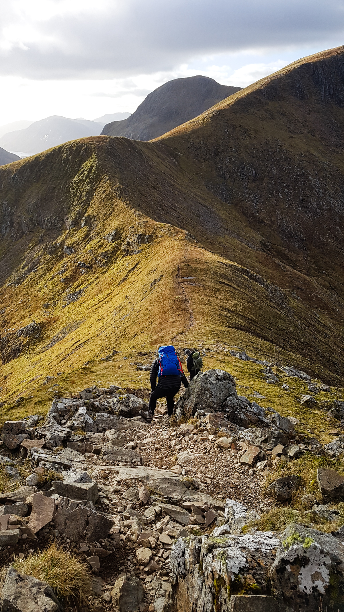
From lunch we set off walking the ridge to the southern tip of the mountain to bag one of two Munro peaks on offer. Unsurprisingly, given the weather, there was an high volume of foot traffic over the mountain: walkers in twos and threes, climbers with ropes and gear, even a few folks running along the path at an impressive pace. I made sure say hello to a few who passed our way, and everyone seemed in great spirits.
From what I could tell, most folks were doing our route in reverse, having climbed up the northernmost face of the Buachaille to begin and making their exit along the valley. Personally I was very happy with our direction as I’m not a big fan of the ‘long walk home’ that comes from a lot of there-and-back routes. Getting to the end of the day and having a long, flat trudge before getting to the car park can be tedious, whereas the way we were walking would give us a quick return to the hut once we began our exit.

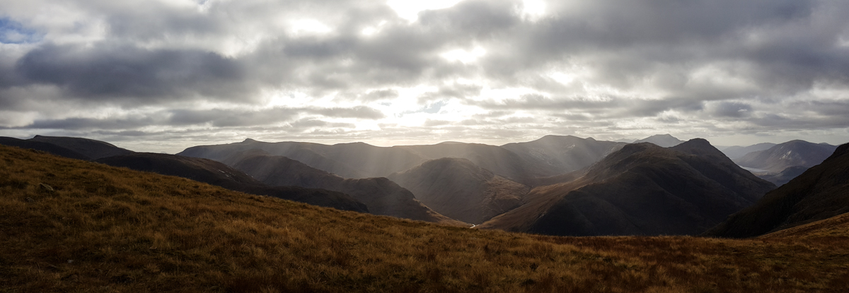
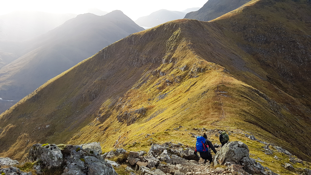
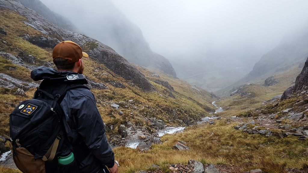
The walk along the tops went smoothly – we reached the summit Stob na Broige easily and took a moment to enjoy a spectacular view. Returning back along that route we passed our lunch spot and clambering up the slope of Stob na Doire for our first 1000m peak. With some sharp climbs and drops we managed to hit the summit of Stob Dearg at the Northernmost point of the mountain.
Our descent was sharp and tricky. Loosely-cut steps in the rock gave way to scree, which turned into a boulder field at the bed of an old river. Over the final hour we only covered about a kilometre of ground on the map, yet dropped over 700m downwards. Across the day I had been feeling fine, taking gentle breaks to snack and drink water, but by the middle of this descending path I felt exhausted. Taking the weight on my knees began to hurt, and my pace suffered. We eventually reached flat ground and trailed back to the hut just as the valley was being dropped back into shadow, giving ourselves some time to recover, pack, and clean up before the drive home.
Interested in sharing your own Field Report? We’d love to share your adventures with others, click here to find out more.